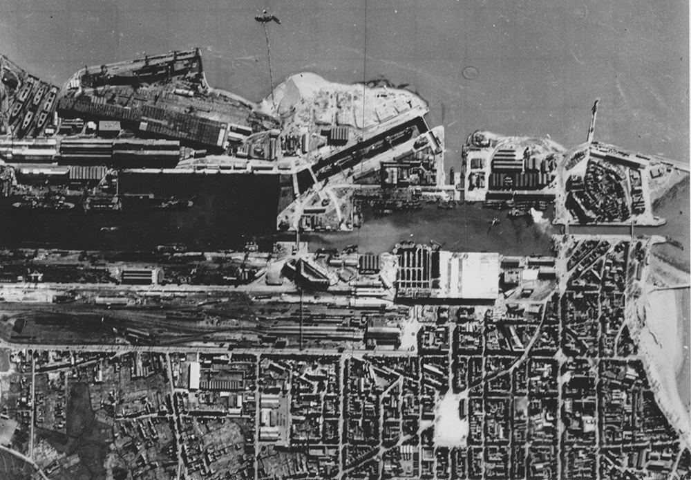
The town and port of St Nazaire lying on the Western side of the River Loire six miles from the sea. The Normandie Dock (Forme Ecluse Louis Joubert) is seen lying at an angle near the mid top of the picture. At the top right jutting out into the river is the Old Mole. The section of water in the middle of the picture is the Submarine Basin with the incomplete submarine pens below and the Southern Entrance to the docks on the right.
3858 x 2676 px (33 x 23 cm) @ 300 DPI
Recently viewed
GSGS 4336 1:100,000 Soissons Sheet 19
£20.00
British Aircraft in the Desert
£7.50
Morser 18 21cm gun
£7.50
Your favourites have been updated. View your favourites by going here.